Show Posts

This section allows you to view all posts made by this member. Note that you can only see posts made in areas you currently have access to.


Messages - Agneshill

Pages: 1 [2] 3 4 5 ... 10
10

In an effort to get a definitive consensus of opinion on the interpretation of the various documents from which you are quoting, would you please scan and post them?

11

Arinacrinachd.

It's a crofting area on the south shore of Loch Torridon between Fearnbeg and Kenmore.

12
Glamorganshire Lookup Requests / Re: Aberfan Inquiry Plan.
« on: Sunday 16 July 17 17:26 BST (UK)  »
Hi,

Many thanks for your reply and the links to the two sources of information. Much appreciated.

I was aware of these already but I was hoping that someone would have something tucked away they could pass on to me or perhaps point me to something which I could access online.

I'll contact the Methyr Library tomorrow to see if they can take my query further by way of some online access.

13
Glamorganshire Lookup Requests / Aberfan Inquiry Plan.
« on: Wednesday 05 July 17 20:05 BST (UK)  »
I 'm hoping that some kind member can help me obtain a copy of a newspaper cutting (or photo) showing the interior of the building used for the Aberfan Inquiry in October 1966.
I was a cartographer working with the Ordnance Survey when we were directed to make detailed plans showing the devastation caused by the landslip that claimed so many young lives.
I also had the privilege of having to draw a very large plan (c. 8' x6') which was used as a backdrop on the wall behind the "top table".

I used to have a newspaper cutting which was from one of the papers of the day but unfortunately over the years I have misplaced it. I know that all the papers and plans are in the safe keeping of the Glamorgan Archives as I have been in touch with them, but as I live about 500 miles away I am not able to make the journey down. They did say that they could carry out a search for me but the cost involved would be considerable bearing in mind the amount of material they have.

I am hoping that someone may have some photos or cuttings showing the interior of the venue which shows my plan in the background or may be a regular user of the Archives?

This quest was started by the tv broadcast which was screened last year to commemorate the disaster.

I'm attaching an image of the plan which I was able to get off the "paused" picture on the tv.


14
Inverness / Re: Jane MacDonald b.1865 Inverness
« on: Thursday 22 June 17 17:01 BST (UK)  »
If I have managed to attach them, here are a couple of plans which show the location of Shuttle Lane.

This link should show the relationship of what used to be Shuttle Lane and the present day. It appears that the Friars Bridge now covers most of what used to be the Lane....

http://maps.nls.uk/geo/explore/sidebyside.cfm#zoom=18&lat=57.4821&lon=-4.2322&layers=168&right=BingHyb


15
Ross & Cromarty / Re: Matheson
« on: Wednesday 18 May 16 18:54 BST (UK)  »

I think I have now sorted the problem.

(The extract is from the 1:2500, 2nd edition, O.S. Plan no. 88.03 (Ross and Cromarty), published in 1906. It can be found on the National Library of Scotland website.)


16
Ross & Cromarty / Re: Matheson
« on: Wednesday 18 May 16 18:10 BST (UK)  »

I forgot to add that burial records for Dingwall (Mitchell Hill Cemetery) were started in 1891. If you are looking for burials before that time then the local Parish Church, St Clement's, should have been the holder of records and the place of burial for most people in the Dingwall area. When I was seeking burials for my MacLeods, I was told that they do not have such records in their keeping, and nobody in authority seemed to think that any formal records were ever kept! (I cannot accept that the Parish Church would happily plant people without some form of record - if only to avoid the unthinkable?)
I therefore assume that some sort of record WAS kept and they are probably now down in Edinburgh with the NLS.

17
Ross & Cromarty / Re: Matheson
« on: Wednesday 18 May 16 17:29 BST (UK)  »

I was intending to attach a couple of location plans for the cottage but have fallen foul of Forum rules which say that files over 900KB cannot be sent. As I added some text on to the plans it has made the files that much bigger. If you send me your email address through the PM system, I'll send them direct to you.

Pyramid Cottage was demolished some 30 years ago to make way for a new link road through the town. I tracked down the last occupant and he identified the property.

Cheers.

18
Ross & Cromarty / Re: Can anyone find a headstone, and take a photo for me?
« on: Thursday 05 November 15 15:44 GMT (UK)  »


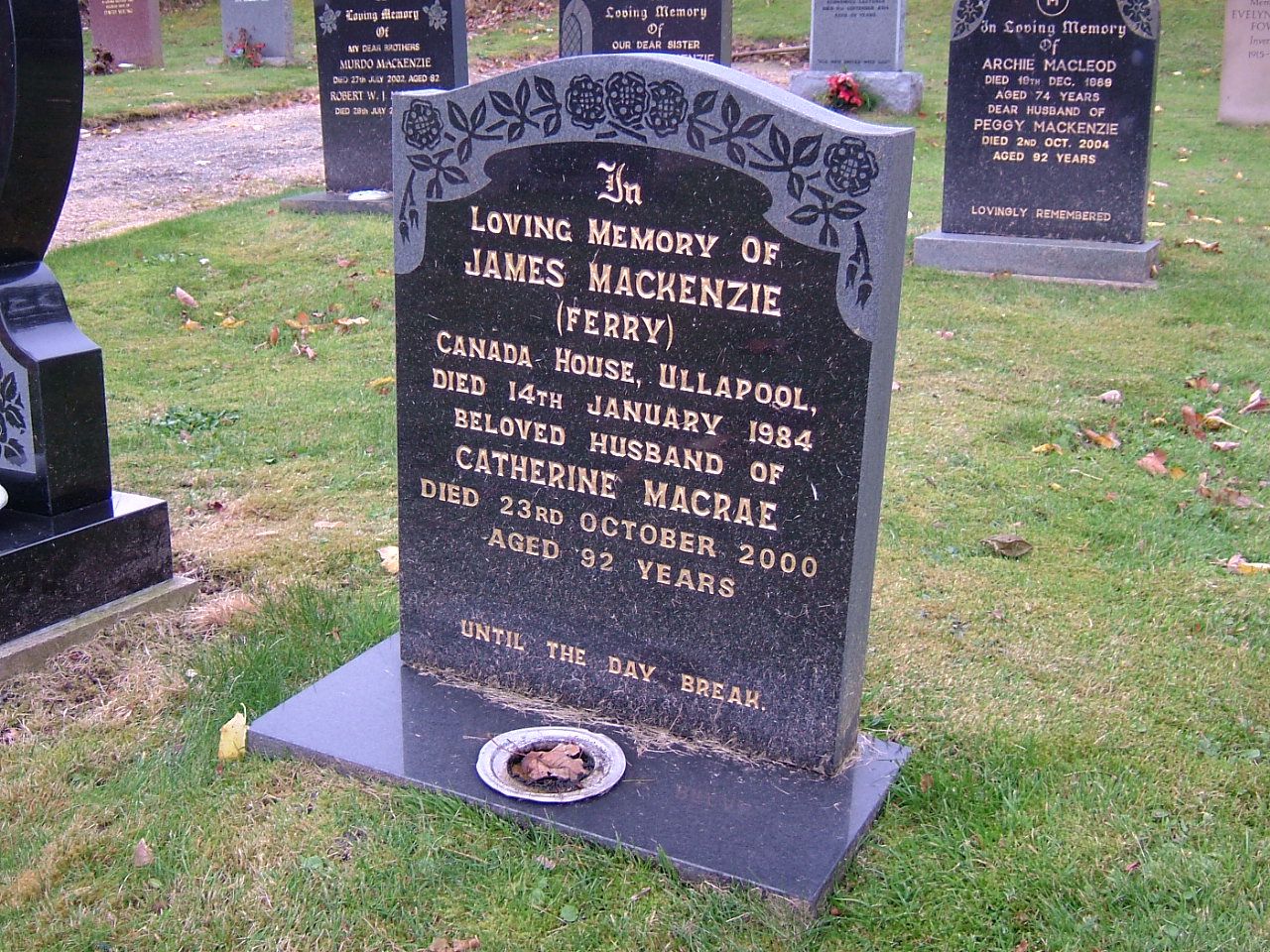
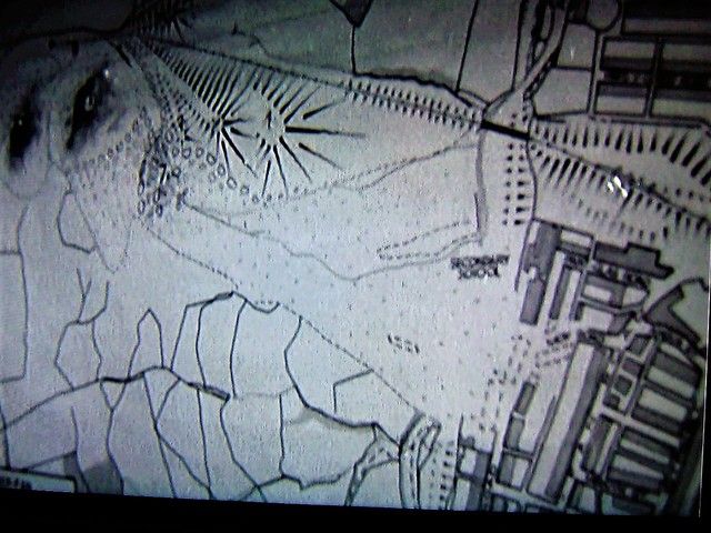
As you weren't sure whether or not there was a headstone, I sought out the Locality Office in Ullapool to track down a Burial Ground layout plan using your clue of Lair #61.
The very helpful assistant remembered your earlier query and I managed to get a photocopy of the layout plan which made finding the grave very easy.

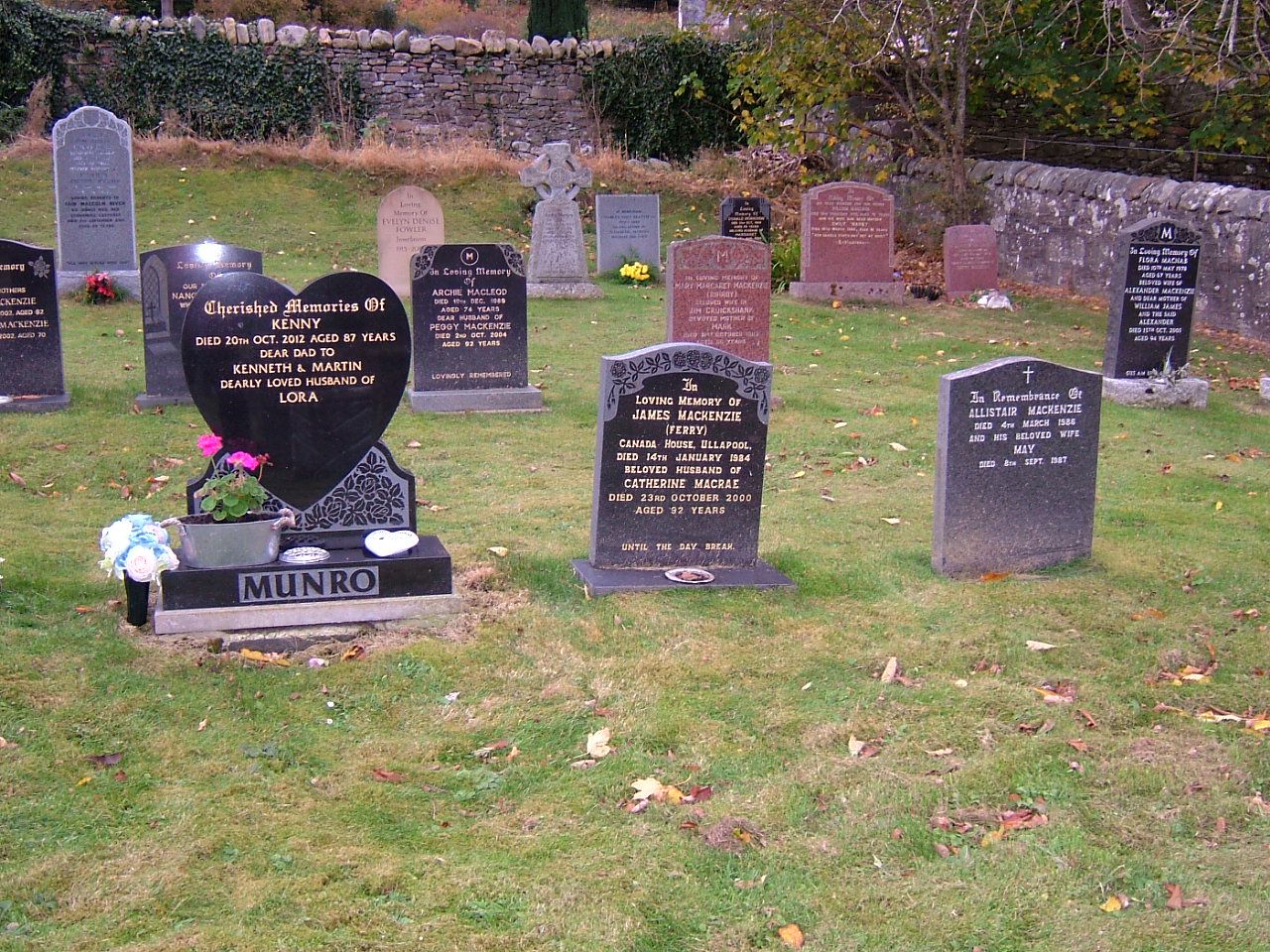
I'm attaching only a few piccies to save the forum's bandwidth, but I've also taken others showing the rest of the burial ground and the grave's location within. If you want these, contact me with your email addy and I'll send them direct.

Curiously, on a much lighter note, there were a couple of coincidences today.
1. I notice that Catherine died on my birthday, 23rd October.
2. I took delivery of my present car on my birthday, 23rd October 1991.
3. The first person I saw upon entering the Locality Office was an ex-colleague (who was visiting and haven't seen for ages) and whom I drove, as a bride to her wedding, in my car a year later!

So all in all, a successful/curious day.


Pages: 1 [2] 3 4 5 ... 10